
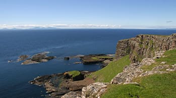
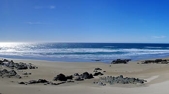
Arran
30 minute crossing from Claonaig to Lochranza operated by Caledonian McBrayne – N.B. Claonaig is 39 miles south of Ardfern.
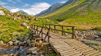
- Impressive mountains and lush glens characterise Arran, making it a haven for walkers and climbers from all over the world. Known as ‘Scotland in Miniature’, Arran is a condensed version of the best that Scotland has to offer; golf, castles, distilleries, outdoor activities and gourmet food.
- One of the most southerly Scottish islands, Arran ’s history is rooted in Celtic myths and legends. Visit Brodick Castle and its’ turbulent past, explore the standing stones on Machrie Moor or find the very cave where Robert the Bruce was supposed to have encountered the spider.
- Or you could eat your way round the island – Arran is fast becoming a foodie destination with a reputation for excellent local produce. Take to the Arran Taste Trail and learn about traditional production techniques as well as sampling the malts, cheeses, beers and chocolates on offer.
- Go horse-riding, play golf on one of the island’s 6 golf courses or get your boots on and climb Goatfell. Whether you choose to spend your day browsing craft shops or paragliding, Arran really does have something for everyone.
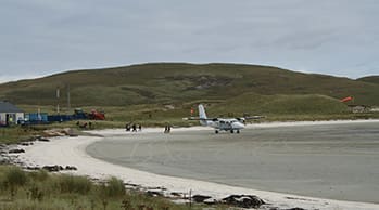
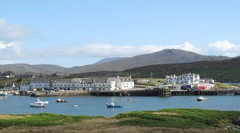
Barra
4 hours 50 minute crossing from Oban to CastleBay operated by Caledonian McBrayne – N.B. Oban is 24 miles north of Ardfern.
- The mainly Gaelic speaking island of Barra, nestled at the foot of the Outer Hebridean chain, is small and perfectly formed. From your first sight of Kisimul Castle standing guard over Castlebay, you know you have arrived in a place where a sense of tradition runs deep.
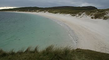
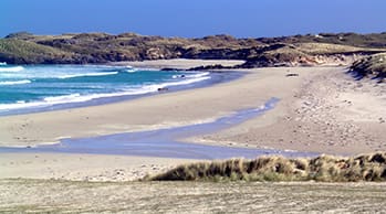
- Barra is only five miles across by eight miles long, with a ring road all the way around it. Barra is a compact paradise with stunning coastal scenery – the island boasts white sandy beaches, remarkable wildlife and diverse flora and fauna. The rare machair environment is home to over 1000 different species of wild flower, including Irish Lady’s Tresses and Wild Rattle. The waters around Barra are also home to a playful, friendly school of dolphins.
- With so much to see, the island is a favourite with walkers and cyclists, many of whom use the island as the starting point for a long distance route of the entire Outer Hebridean chain.
Benbecula
6 hour 40 minute crossing from Oban to Lochboisdale (South Uist), operated by Caledonian McBrayne, then a 35 minute drive – N.B. Oban is 24 miles north of Ardfern.
- The first written record of the name is as "Beanbeacla" in 1449. Historically this name is assumed to derive from Peighinn nam Fadhla "pennyland of the fords" as the island is essentially flat. Benbecula has historically been a very strong Gaelic-speaking area.
- The island lies between the islands of North Uist and South Uist, to which it is connected by road causeways. Benbecula's main settlement is Balivanich (Scottish Gaelic: Baile a' Mhanaich, meaning "Town of the Monk") in the northwest. It is the main administrative centre for the three islands, and has the council offices and the administrative centre for the artillery deep sea firing range on South Uist. The village is also home to the airport and the island's bank. The township of Lionacleit is also an important one, housing the Uists' main secondary school, which also doubles as a community centre containing a swimming pool, cafeteria, sports facilities, a small museum and a library.
- Borve Castle is a ruined 14th century tower house, located at the south-west of the island. MacGibbon and Ross attributed the building of the tower to Amie MacRuari, the divorced wife of John of Islay, and dated its construction to between 1344 and 1363. It was occupied by the Macdonalds of Benbecula until the early 17th century.
Berneray
6 hour 40 minute crossing from Oban to Lochboisdale (South Uist), then a 1¼ hour drive or alternatively a 1 hour 45 minute crossing from Uig (Isle of Skye) to Lochmaddy, then a 15 minute drive. Both ferry services operated by Caledonian McBrayne – N.B. Oban is 24 miles and Uig (Isle of Skye) is 191 miles (4½ hours) north of Ardfern.
- It is famed for its rich and colourful history which has attracted much tourism. With an area of 10.1 square kilometres (2496 acres), Berneray rises to a height of 305 feet (93 m) at Beinn Shlèibhe (Moor Hill) and 278 feet (85 m) at Borve Hill. There is strong evidence that points to Berneray being inhabited since the Bronze Age, and possibly before. The island is scattered with ancient sacred sites, stone circles, signs of Viking inhabitation and historical buildings, some several centuries old.
- The name "Berneray" is from the Old Norse Bjarnar-øy and means either "Bjorn's island" or possibly "bear island". The main industries are fishing, crofting (small-scale individual farming), media/IT and tourism. Broadband internet provision became available in January 2006, giving an incentive to people wishing to relocate to Berneray and helping sustain the population and community. Possibly the greatest change in modern times occurred in 1999 when the causeway opened between Berneray and Otternish on North Uist. This has eased travelling on and off the island, improving employment prospects and accelerating the carriage of produce (notably, crabs and lobster). The causeway contains culverts that allow the easy passage of otters and fish from one side of the structure to the other. The causeway was formally opened by Prince Charles in April 1999.
Canna
A 3 hour 5 minute crossing (certain days only) from Mallaig to Canna via Eigg and Rum or a 2 hour 30 minute crossing via Rum only (certain days only), both operated by Caledonian McBrayne – N.B. Mallaig is 111 miles (2½ hours) north of Ardfern.
- The islands were left to the National Trust for Scotland (NTS) by their previous owner, the Gaelic folklorist and scholar John Lorne Campbell in 1981, and are run as a farm and conservation area. Canna House, one of two big houses on the island (the other being Tighard), contains John Campbell's important archives of Gaelic materials that were donated with the islands to the nation. Since then the NTS has engaged in new initiatives to attract new residents and visitors to the island.
- The island has a very low crime rate, but a mainland-based policeman visits the island twice a year, mainly to inspect gun licences. A doctor based on the neighbouring island of Eigg is available for house calls once a month. The roads on Canna are not metalled and are privately owned; local vehicles therefore do not require road tax. The previous footbridge to Sanday was destroyed by storms during 2005, and has recently been replaced by a road bridge. This allows vehicular access at all tide levels for the first time, although the road on Sanday is still covered by high tides.
Coll
2 hours 40 minute crossing from Oban to Arinagour operated by Caledonian McBrayne – N.B. Oban is 24 miles north of Ardfern.
- Crofting, lobster fishing and lobster farming form the basis of the thriving island community that is Coll. Loved by birdwatchers, nature lovers, archaeologists and those in search of peace and tranquility, this is the perfect place to get away from everything.
- The low, lying island of Coll is characterised by its landscape of sandy beaches, freshwater lochs, Lewisian bed-rock and machair and the island’s only village is the quiet, fishing village of Arinagour. It’s the perfect place for those wishing to escape modern life and do nothing more strenuous than walk the island’s beaches or discover the local flora and fauna. In summer particularly, the sound of skylarks, the fragrance of the flowers and the views of distant shimmering islands make this a very special place.
- From May to August, Coll’s RSPB reserve play a crucial role in the protection of the corncrake, a bird that is globally endangered but one of the rarest and fastest declining in the UK due to intensive agricultural methods. On this reserve, and throughout the islands, the RSPB encourage corncrake-friendly farming methods. However, the corncrake is just one of many species found on the island – the opportunity to see redshanks, lapwing, snipe and in winter, barnacle and Greenland white-fronted geese make this an ornithologist’s paradise.
- And its not just a place for nature lovers, those interested in the islands heritage will be fascinated by Coll’s iron-age forts, crannogs and “Na Sgeulachan” (Teller of Tales) standing stones.
Colonsay
2 hour crossing from Oban to Scalasaig operated by Caledonian McBrayne – N.B. Oban is 24 miles north of Ardfern.
- Colonsay, a delightful little island only eight miles in length, can be reached by ferry from Oban three times a week. At low tide, Colonsay is joined to Oronsay, one of many Scottish Islands bearing this name - it means tidal island.
- The island has around one hundred inhabitants most of whom live in the main village of Scalasaig (where the ferry terminal is located), with most of the remaining population split between the hamlets of Kiloran and Kilchattan.
- Colonsay is an ideal place for those with an interest in archaeology as artefacts dating back to the Stone Age have been found here. There are also many historical ruins and ecclesiastical relics on the island.
- Both islands are noted for the diversity of their wild flowers with more than four hundred species recorded.
Eigg
A 1 hour 15 minute crossing from Mallaig to Eigg, operated by Caledonian McBrayne – N.B. Mallaig is 111 miles (2½ hours) north of Ardfern.
- Eigg is dominated by “an Sgurr”, a dramatic pitchstone ridge, the largest of its kind in Europe. Laig bay, a large white Atlantic beach, faces the Cuillins of Rum, one of the most memorable views on the west coast of Scotland.
- Further North is the Singing Sands, a stunning musical quartz beach surrounded by outstanding geological formations. As well as being known as the jewel in the Hebridean crown for its outstanding beauty, Eigg has many other cultural and historical attractions: Picts and Vikings have left their marks, and its rich history is steeped in clan warfare and the crofting way of life.
- Eigg’s pioneering community buy-out ushered in land reform in Scotland, giving islanders control of their future for the first time. Among other achievements, Eigg has the first completely wind, water and sun-powered electricity grid in the world.Eigg’s pioneering community buy-out ushered in land reform in Scotland, giving islanders control of their future for the first time. Among other achievements, Eigg has the first completely wind, water and sun-powered electricity grid in the world.
Eriskay
6 hour 40 minute crossing from Oban to Lochboisdale (South Uist) operated by Caledonian McBrayne, then a short drive over the causeway to Eriskay – N.B. Oban is 24 miles north of Ardfern.
- Although only a small island (about 2.5 x 1.5 miles), Eriskay has many claims to fame that have made the island well-known far beyond the Hebrides. It is associated with the traditional Hebridean song, the Eriskay Love Lilt; with the Eriskay pony and the Eriskay jersey (made without any seams). It is the real Whisky Galore! island: it was just off Eriskay that the SS Politician ran aground in 1941 with its famous cargo. On 2 August 1745 the small frigate le Du Teillay landed Bonnie Prince Charlie with his "seven men of Moidart" on Eriskay to start the 'Forty-Five Jacobite Rising. An important early documentary film, Eriskay: A Poem of Remote Lives, made by a German traveller, Werner Kissling, was set on the island.
- There is a well-stocked shop in Eriskay, a community centre and the Politician Lounge Bar (named after the ship which serendipitously ran aground and famously provided the island with a generous supply of free whisky). The Roman Catholic church of St. Michael's sits on a hill overlooking the main village on Eriskay. It celebrated its centenary in 2003, having been built by Father Allan MacDonald in 1903. The site of the old church is marked by a memorial garden with a statue of the Virgin Mary, overlooking the Sound of Barra.
Gigha
20 minute crossing from Tayinloan to Ardminish operated by Caledonian McBrayne – N.B. Tayinloan is 48 miles south of Ardfern.
- The small Island of Gigha lies between Islay and Kintyre and can be accessed by ferry from Tayinloan on Kintyre.
- The island has many fabulous white sandy beaches to the south that visitors can explore by foot or bicycle, which can be hired from the local shop. A visit to the famous Achamore House Gardens will find you wandering through 50 acres of exotic shrubs.
- Those interested in Celtic culture should seek out the Gam Stone on the West Side of Gigha. Carved on the stone is an example of Celtic writing that is so old and rare that it has not yet been fully deciphered.
- Other ancient relics such as forts, standing stones and chapels can be found all over the island. For those who enjoy a game of golf there is a very nice 9-hole course a little to the north of Ardminish, the main village.
- Don't forget to sample the local hospitality at the island's only inn.
Harris
1 hour 40 minute crossing from Uig (Isle of Skye) to Tarbert, operated by Caledonian McBrayne – N.B. Uig (Isle of Skye) is 191 miles (4½ hours) north of Ardfern.
- Harris is the southern and more mountainous part of Lewis and Harris, the largest island in the Outer Hebrides. Harris divides naturally into northern and southern parts which are separated by West and East Loch Tarbert.
- North Harris, adjoining Lewis, contains Clisham (An Cliseam), the highest mountain in the Outer Hebrides at 799 metres (2,621 ft). The area is sparsely populated. Beyond Tarbert, the furthest settlement is Hushinish on the west coast. A bridge from the east coast links Harris to the island of Scalpay.
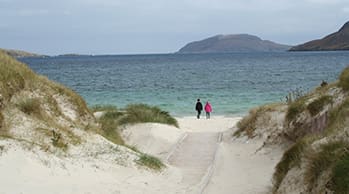
- The southern part of Harris is less mountainous, with numerous unspoilt, white sandy beaches on the west coast. Its main settlements are Rodel, known for its medieval kirk of St. Clement, the most elaborate surviving medieval church in the Hebrides after Iona Abbey, and Leverburgh.
- The beaches of Luskentyre and Scarista are amongst the most spectacular. From the former the island of Taransay, where the BBC Television series Castaway 2000 was recorded, is seen most clearly from Harris. At Scarista the beach is a venue for surfing and kite buggying.
Iona
40 minute crossing from Oban to Craignure operated by Caledonian McBrayne, then a 1 hour 20 minute bus journey from Craignure to Fionnphort operated by Bowmans Tours (service no 496), then 10 minute crossing from Fionnphort to Iona operated by Caledonian MacBrayne – N.B. Oban is 24 miles north of Ardfern.
- Iona is an enchanting, magical, and very special place. Today some 140,000 people make their way here each year. In doing so, they follow in the footsteps of pilgrims who have been coming to Iona since not long after St Columba's arrival in AD563: and of tourists who have been visiting for over three hundred years since Martin Martin published his guide to the Hebrides in 1703.
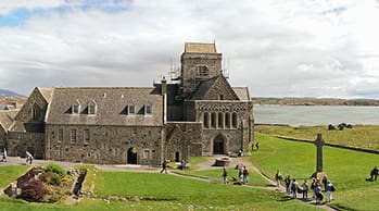
- Iona is a small island some 3½ miles long and, at its widest, 1½ miles wide. Along with a selection of lovely white beaches, Iona is renowned for its Abbey. It is difficult to believe today that this stood as a crumbling ruin from the late 1500s until the 8th Duke of Argyll started preservation work in the years from 1874. In 1899 he transferred ownership to the Iona Cathedral Trust, and in 1902 work began on a restoration that was only completed, under the auspices of the Iona Community, in 1965. In 2000, care for the abbey, nunnery and historical monuments was passed by the Iona Cathedral Trust to Historic Scotland.
- Today's visitors to Iona Abbey can only marvel at the quality of the workmanship that went into transforming a ruin back into a living, breathing place of worship. During your visit make sure you leave time to see the intimacy of the Michael Chapel, at the rear of the abbey complex, while near it is the abbey infirmary, now the Infirmary Museum. This is home to one of the best collections of stone crosses and grave slabs you are likely to find anywhere in Scotland.
Islay
2 hour 10 minute crossing from Kennacraig to Port Ellen or 2 hour crossing from Kennacraig to Port Askaig operated by Caledonian McBrayne – N.B. Kennacraig is 35 miles south of Ardfern.
- The Scottish Isle of Islay is part of the southern Hebrides and is inhabited by approx. 3200 people. The Isle of Islay is also called Queen of the Hebrides and with 8 working whisky distilleries, the spectacular scenery and all the friendly people, Islay is a great holiday destination.
- The Isle of Islay is the southernmost island of the Inner Hebrides of Scotland and lies in Argyll and Bute. Jura, Kintyre and Northern Ireland are Islay's neighbours. Islay is pronounced as Eye-la. The earliest known reference to the Isle of Islay comes in Adamnan's biography, Vita Columbae, of the Irish Saint, Columba, written in about 720 AD. St Columba visited the Isle of Islay on his way north, prior to setting up the famous monastery on the island of Iona, of the south-west tip of Mull. Adamnan wrote it as "Ilea", describing it as an inhabited island, which was later transformed to Islay being the anglicised spelling; in Gaelic the island is still spelt Ile.
Jura
2 hour crossing from Kennacraig to Port Askaig operated by Caledonian McBrayne, then take the 5 minute ferry operated by Argyll & Bute Council from Port Askaig to Feolin Ferry – N.B. Kennacraig is 35 miles south of Ardfern.
- Jura comes from the Norse words meaning Deer Island. Today over 6500 deer live on six estates on the island. In contrast, the human population is less than 200.
- The island is 29 miles long and 7 miles wide in places. The west is wild and virtually uninhabited, occupied only by the three Paps of Jura which are known in Gaelic as The Mountain of the Sound, The Mountain of Gold and The Sacred Mountain. The island's annual Fell Race takes place on the last weekend in May.
- Many caves and raised beaches can be found on the west coast, but you'll have to be a good walker to reach them.
- Jura's only road leads up the east coast (public transport is limited to a minibus, so it's best if you have your own car). If you want to get away from it all, this is the place to come. The novelist George Orwell who stayed on the island at Barnhill during the 1940s quite rightly described it as "an extremely un-getatable place".
Lewis
1 hour 40 minute crossing from Uig (Isle of Skye) to Tarbert (Isle of Harris), then a 50 minute drive to Stornoway or alternatively a 2 hour 30 minute crossing from Ullapool to Stornoway. Both ferry services operated by Caledonian McBrayne – N.B. Uig (Isle of Skye) is 191 miles (4½ hours) and Ullapool is 179 miles (4 hours) north of Ardfern.
- Lewis is, in general, the lower lying part of Lewis and Harris, with the other part, Harris, being more mountainous. The flatter, more fertile land means Lewis contains the largest settlement, Stornoway, and three-quarters of the population of the Western Isles. Beyond human habitation, the island's diverse habitats are home to an assortment of flora and fauna, such as the golden eagle, red deer and seals and are recognised in a number of conservation areas.
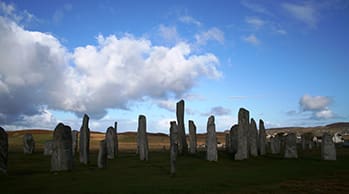
- The first evidence of human habitation on Lewis is found in peat samples which indicate that about 8,000 years ago, much of the native woodland was torched to make way for grassland to allow deer to graze. The earliest archaeological remains date from about 5,000 years ago. At that time, people began to settle in permanent farms rather than following their herds. The small houses of these people have been found throughout the Western Isles, in particular, at Dail Mhor, Carloway. The more striking great monuments of this period are the standing stones and communal burial cairns at places like Callanish.
Lismore
50 minute crossing from Oban to Achnacroish operated by Caledonian McBrayne – N.B. Oban is 24 miles north of Ardfern.
- Lismore is an unusual island in that it is almost entirely composed of limestone terrain and everywhere there is evidence of historic lime works. It is barely 16km long and about 2.4km broad but its position and relative fertility gives it historic significance.
- In fact, such was St Moluag’s rush to secure Lismore as a base for his monastery before his contemporary St Columba, that he cut off his pinkie and hurled it onto the shore, thereby staking his claim.
- Lismore has a tranquil, rolling landscape and is ideal for cyclists. The main village of Achnacroish lies halfway along the island’s eastern coast. As well as having the shop and the school, the village is the terminal for the main ferry service from Oban.
- The highest point on the island is the hill at the southern end known as Barr Mòr - at just short of 130m high, the views from this low summit are unforgettable.
- Image courtesy of Simaron: http://www.flickr.com/photos/simaron/
Luing
5 minute crossing from Cuan on the Isle of Seil to Luing operated by Argyll & Bute Council Ferry – N.B. Cuan is 28 miles north of Ardfern.
- Luing measures some six miles long by one-and-a-half wide, and lies north-south across the mouth of Loch Melfort on the Argyll coast. It is generally low lying, with a maximum height of about 300 feet, and it has a population of around 200. It is reached by a frequent ferry service across the two hundred yards of the Cuan Sound from the southern tip of Seil.
- The largest centre of population is at Cullipool in the north west of the island. This attractive village of bright white cottages is set starkly against the slate that makes up its beach, and whose quarrying underpinned the economy of the island for many years. Slate was still being extracted from the quarries at the north end of Cullipool until 1965. At its height the industry employed 170 men on the island and extracted three quarters of a million slates each year.
- Luing's only shop, the Luing Store, can be found beside the road as it heads into Cullipool, and the village is also the location of the only public toilets on the island. There are, however, more aesthetic reasons to visit Cullipool: it has a reputation for wonderful sunsets framed by the islands to the west, and with the slate revealing that when the light is right it has much more to offer the eye than a uniform dark grey.
Muck
A 1 hour 40 minute direct crossing (certain days only) from Mallaig to Muck or a 2 hour 5 minute crossing via Eigg, operated by Caledonian McBrayne – N.B. Mallaig is 111 miles (2½ hours) north of Ardfern.
- Muck is the smallest of four main islands in the Small Isles, part of the Inner Hebrides of Scotland. It measures roughly 2.5 miles (4.0 km) east to west and has a population of around 30, mostly living near the harbour at Port Mòr.
- A causeway and slipway were built at Port Mòr in 2005. This allows vehicles to be driven on and off the Caledonian MacBrayne ferry, MV Lochnevis, which links Muck and the neighbouring Small Isles of Canna, Rùm and Eigg, with the mainland port of Mallaig. However, visitors are not normally permitted to bring vehicles to the Small Isles. During the summer months the islands are also served by Arisaig Marine's ferry MV Sheerwater from Arisaig, 10 miles (16 km) south of Mallaig.
- The island's main hill is Beinn Airein (137 metres (449 ft)). Muck is also known for its seal population, and for the porpoises in the surrounding waters. The name may derive from the Gaelic word for porpoise. An earlier owner, who disliked the name, attempted to persuade Samuel Johnson and James Boswell that the authentic name was "Isle of Monk".
Mull
40 minute crossing from Oban to Craignure operated by Caledonian McBrayne – N.B. Oban is 24 miles north of Ardfern.
- Mull, the second largest of the Hebrides, is easily accessible with a regular service from Oban.
- The island is an island of peninsulas giving it a long and varied coastline that offers visitors endless days of exploration and discovery. The mountains that stretch across the middle of the island rise to over 900 metres and are particularly popular with hill walkers. Mountain ranges in the south and the east are pierced by glens and waterfalls.
- The population of around 3000 is well spread throughout the island, and the ferry terminals at Tobermory, Fishnish and Craignure are well used.
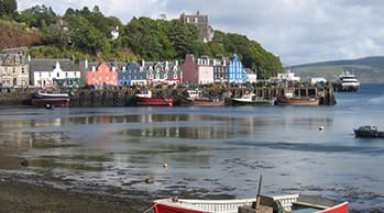
- The island's main town of Tobermory is the setting of the CBeebie's series, 'Balamory'. As a result, Tobermory has become the top holiday destination for kids desperate to see the colourful houses where PC Plum and Suzie Sweet live.
- Mull is home to a wide range of wildlife and is one of best places in Europe to see the Golden Eagle (Aquila chrysaetos) and White Tailed Sea Eagle. It also offers a home to the elusive European Otter (Lutra Lutra).
- Organised Whale and Dolphin watching trips on which Minke Whales and Dolphins among others can be seen, are available on the Island.
- Isle of Mull Wildlife Expeditions, founded by David Woodhouse, is at the forefront of eco-tourism initiatives in Scotland and has been operating for over 25 years.
- Wildlife lovers will be interested to know that there are over 100 species of birds (including golden eagles) on the island, together with wild goats, seals, rabbits, hares, stoats and otters.
- The main religious and historical attractions are the key elements of any visit to Iona: but there is much, much more here besides. The Iona Community operate a gift and book shop opposite the abbey, and the island also offers a further bookshop, other shops, a pottery and a gallery, and an arts and crafts centre.
North Uist
6 hour 40 minute crossing from Oban to Lochboisdale (South Uist), then a 1 hour drive or alternatively a 1 hour 45 minute crossing from Uig (Isle of Skye) to Lochmaddy, both operated by Caledonian McBrayne – N.B. Oban is 24 miles and Uig (Isle of Skye) is 191 miles (4½ hours) north of Ardfern.
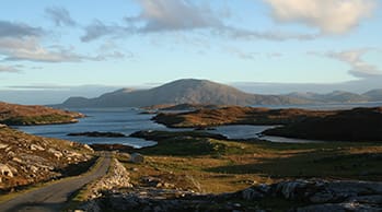
- North Uist is the tenth largest Scottish island. With the exception of the south east, the island is very flat, and covered with a patchwork of peat bogs, low hills and lochans, with more than half the land being covered by water. Some of the lochs contain a mixture of fresh and tidal salt water, giving rise to some complex and unusual habitats. Loch Sgadabhagh, about which it has been said "there is probably no other loch in Britain which approaches Loch Scadavay in irregularity and complexity of outline", is the largest loch by area on North Uist. On a clear day there is a viewpoint from which St Kilda can be seen.
- The main settlement on the island is Lochmaddy, a fishing port and home to a museum, an arts centre and a camera obscura. The island's main villages are Sollas, Hosta, Tigharry, Hougharry, Paible, Grimsay and Cladach Kirkibost. Other settlements include Clachan Carinish, Knockquien, Port nan Long, Greinetobht and Scolpaig, home to the nineteenth century Scolpaig Tower folly.
- The main settlement on the island is Lochmaddy, a fishing port and home to a museum, an arts centre and a camera obscura. The island's main villages are Sollas, Hosta, Tigharry, Hougharry, Paible, Grimsay and Cladach Kirkibost. Other settlements include Clachan Carinish, Knockquien, Port nan Long, Greinetobht and Scolpaig, home to the nineteenth century Scolpaig Tower folly.
Raasay
A 164 mile (3¾ hour) drive over the Bridge of Skye to Sconser (Isle of Skye) and a 25 minute crossing from Sconser to Raasay, or alternatively a 30 minute crossing from Mallaig to Armadale, and a 30 mile (40 mins) drive from Armadale to Sconser. Both ferry services operated by Caledonian McBrayne – N.B. Mallaig is 111 miles (2½ hours) north of Ardfern.
- Raasay is an island between the Isle of Skye and the mainland of Scotland. It is separated from Skye by the Sound of Raasay and from Applecross by the Inner Sound. It is most famous for being the birthplace of the poet Sorley MacLean, an important figure in the Scottish literary renaissance.
- Traditionally the home of Clan MacSween, the island was ruled by the MacLeods from the 15th to the 19th century. Subsequently a series of private landlords held title to the island, which is now largely in public ownership. Raasay House, which was visited by James Boswell and Samuel Johnson in 1773, is now an outdoor activity centre. Raasay means "Isle of the Roe Deer" and is home to an endemic subspecies of Bank Vole.
- Following Viking expeditions to the islands they called the Suðreyjar in the eighth century, Raasay became part of the Norse Kingdom of the Isles and for much of the period religious observance came under the jurisdiction of the Bishopric of the Isles.
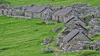
Rum
A 1 hour 20 minute direct crossing (certain days only) from Mallaig to Rum or a 2 hour 30 minute crossing via Eigg, operated by Caledonian McBrayne – N.B. Mallaig is 111 miles (2½ hours) north of Ardfern.
- It is the largest of the Small Isles, and the fifteenth largest Scottish island, but is inhabited by only about thirty or so people, all of whom live in the village of Kinloch on the east coast. The island has been inhabited since the 8th millennium BC and provides some of the earliest known evidence of human occupation in Scotland.
- The early Celtic and Norse settlers left only a few written accounts and artefacts. From the 12th to 13th centuries on, the island was held by various clans including the MacLeans of Coll. The population grew to over 400 by the late 18th century but was cleared of its indigenous population between 1826 and 1828.
- The island then became a sporting estate, the exotic Kinloch Castle being constructed by the Bulloughs in 1900. Rùm was purchased by the Nature Conservancy Council in 1957.
Seil
N.B. Isle of Seil is 21 miles north of Ardfern.
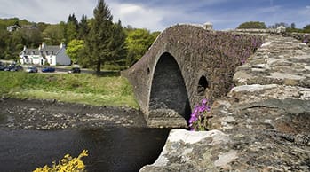
- Opinions differ about whether Seil should be counted as an island at all. The Atlantic Bridge or "Bridge Over the Atlantic" mentioned on the signpost links Seil to the mainland. It is more properly known as the Clachan Bridge and was built in 1792/3 for the sum of £450. The single arch of the bridge is 72ft wide and is steeply humped to provide a clearance above high water of 28ft to avoid obstructing the passage of small vessels. Originally designed to have two arches by John Stevenson of Oban, the plans were amended to the single arch that was built by Robert Mylne.
- Just over the bridge you come to the attractive and welcoming Tigh an Truish Inn. The name means house of the trousers and comes from the period after the 1745 rebellion when kilts were banned. This was the place where islanders heading for the mainland (then without the benefit of the bridge) were said to have swapped their kilts for trousers.
- Seil is an interesting island, and one of remarkable contrasts; plus a history that adds greatly to its fascination. It makes an excellent day out, and has the added advantage of being one of the few Scottish Islands for which a ferry timetable is not needed.
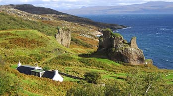
Skye
A 142 mile (3¼ hour) drive to the Bridge of Skye or 30 minute crossing from Mallaig to Armadale, operated by Caledonian McBrayne – N.B. Mallaig is 111 miles (2½ hours) north of Ardfern.
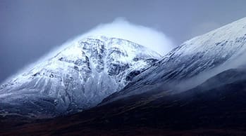
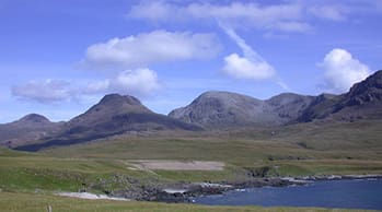
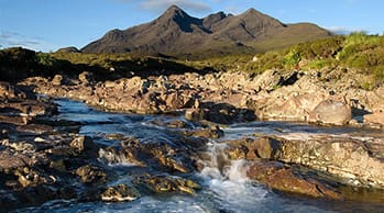
- The largest and most northerly large island in the Inner Hebrides of Scotland. The island's peninsulas radiate from a mountainous centre dominated by the Cuillins, the rocky slopes of which provide some of the most dramatic mountain scenery in the country.
- The island has been occupied since the Mesolithic period and its history includes a time of Norse rule and a long period of domination by Clan MacLeod and Clan Donald. The 18th-century Jacobite risings led to the breaking up of the clan system and subsequent Clearances that replaced entire communities with sheep farms, some of which also involved forced emigrations to distant lands.
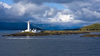
- The main industries are tourism, agriculture, fishing and whisky-distilling. Skye is part of the Highland Council local government area. The island's largest settlement is Portree, known for its picturesque harbour. There are links to various nearby islands by ferry and, since 1995, to the mainland by a road bridge. The climate is mild, wet and windy. The abundant wildlife includes the golden eagle, red deer and Atlantic salmon.
South Uist
6 hour 40 minute crossing from Oban to Lochboisdale operated by Caledonian McBrayne – N.B. Oban is 24 miles north of Ardfern.
- South Uist can be accessed from Oban and Barra by ferry and by road from Benbecula and North Uist. The ferry terminal is situated in Lochboisdale (South Uist's largest village on the east side).
- South Uist is the larger of the two islands and is also the only one with hills of significant height. These are concentrated on the east side of the island, the west being beautiful machair land, which in the springtime, becomes a carpet of wild flowers lying above a beautiful sandy beach which runs more or less continuously from one end of the island to the other.
- South Uist is a birdwatcher's paradise where countless varieties of waterfowl, seabirds, waders, and moorland birds can be spotted.
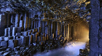
Staffa
40 minute crossing from Oban to Craignure operated by Caledonian McBrayne, then a 1 hour 20 minute bus journey from Craignure to Fionnphort operated by Bowmans Tours (service no 496), then 10 minute crossing from Fionnphort to Iona operated by Caledonian MacBrayne. Thereafter, take a privately operated boat tour to Staffa – N.B. Oban is 24 miles north of Ardfern.
- Staffa is one of the smallest islands in the Southern Hebrides and is famed for Fingal's Cave. But apart from that, Staffa is a remarkable little island, located south-west off the isle of Ulva and halfway between the Ross of Mull and the Treshnish Isles. The island, small as it is with only 33 hectares, was once inhabited in the 1700s by as much as 16 people but nowadays seabirds and tourists have taken over their place. It was donated to the National Trust of Scotland by Jock Elliott from New York in 1986. Staffa is now a Site of Special Scientific Interest.
- Staffa, an entirely volcanic island, is probably best known for its unique geological features such as the many caves and the unique shape of the basalt columns which are also found in the Giant's Causeway and Rathlin island in Northern Ireland and closer by on the island of Ulva. It consists of a basement of tuff, underneath colonnades of a black fine-grained Tertiary basalt, overlying which is a third layer of basaltic lava lacking a crystalline structure. By contrast, slow cooling of the second layer of basalt resulted in an extraordinary pattern of predominantly hexagonal columns which form the faces and walls of the principal caves. The lava contracted towards each of a series of equally spaced centres as it cooled and solidified into prismatic columns. The columns typically have three to eight sides, six being most common.
- The island didn't play an important role in history but was nevertheless visited by many famous people such as Felix Mendelssohn, who composed the Hebrides Overture which is also known as, and is inspired by, Fingal's Cave. Other well known people that made the trip to Staffa are Sir Walter Scott, William Wordsworth an English poet, Queen Victoria and Prince Albert, Jules Verne and Dr David Livingstone to name a few.
Tiree
2 hour 40 minute crossing from Oban to Arinagour on Coll, then a 55 minute crossing from Arinagour to Scarinish on Tiree operated by Caledonian McBrayne – N.B. Oban is 24 miles north of Ardfern.
- Lying to the south west of Coll, Tiree clings to the very edge of the Atlantic ocean. Apart from two small hills, Tiree is flat and green, making it an ideal location for recreational walking and cycling. Other popular activities on the island are golf and fishing. Scarinish, the main village on Tiree, houses shops and a hotel as well as providing the Ferry Terminal for the island. The coastline of Tiree is a mixture of rocky outcrops and long stretches of white sandy beach which, along with the uninterrupted Atlantic winds, makes Tiree a perfect place for windsurfing.
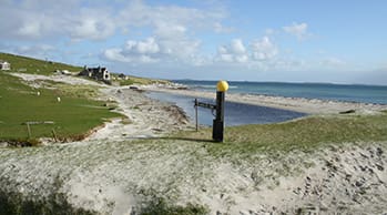
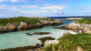
Vatersay
4 hours 50 minute crossing from Oban to CastleBay operated by Caledonian McBrayne, then a short drive over the causeway to Vatersay – N.B. Oban is 24 miles north of Ardfern.
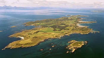
- The westernmost permanently inhabited place in Scotland, Vatersay is linked to Barra by a causeway completed in 1991. At low tide, the island is also linked to the islet of Uineasan to the east.
- The island has remains of an Iron Age broch at Dun a' Chaolais overlooking the Sound of Vatersay and nearby is a passage grave dated to the 3rd millennium BC. There is also a Bronze Age cemetery at Treasabhaig south of the heights of Theiseabhal Mòr and a cairn built circa 1000 BC west of the village of Vatersay. The offshore islet of Biruaslum has a walled fort that may be of Neolithic provenance.
- One of the saddest events to befall the island happened when the Annie Jane, a three-masted immigrant ship out of Liverpool bound for Montreal, Canada, struck rocks off West Beach during a storm in September 1853. Within ten minutes the ship began to founder and break up casting 450 people into the raging sea. In spite of the conditions, islanders tried to rescue the passengers and crew. There were only a few survivors rescued. A small cairn and monument marks the site where the bodies recovered from the sea were buried. An inscription reads: On 28th September 1853 the ship Annie Jane with emigrants from Liverpool to Quebec was totally wrecked in this bay and threefourths of the crew and passengers numbering about 350 men women and children were drowned and their bodies interred here.